Overview: Sensing the Environment
July 15, 2017
Sensing the Environment: A Citizen Science/Connected Learning project
A citizen science/collaborative research/education project between Make+Think+Code@PNCA, Intel Labs, and various community/industry groups to use science, technology, data, art, and design to better understand our ecosystems, and the habitats and behaviors of birds and other life that share our environment. We focus on the urban environment as well as the various watersheds and wildlife corridors surrounding the Portland Metropolitan Area.
A joint endeavor between students, artists and designers, researchers, data scientists, technologists, environmental/conservation groups, and educators.
Join Us For the Project
The Goal(s):
Design, build sensor kits to gather environmental data; Create an open-source database that stores and categorizes data as a resource for research scientists, environmental/conservation/civic/ government organizations and for educators; use techniques of data science (including deep learning) to analyze and interpret the data; discover and tell the stories about these species and spaces by creating a variety of visualizations, maps, and immersive interactive experiences. Develop curricular modules for k-12.
The First Project: Acoustic monitoring
Detect, track, and identify birds and bats through sound. We currently have very little data for the region and new technology allows us to create an affordable (wireless), self-sustaining device that can detect, record, and store/transmit birdcalls.
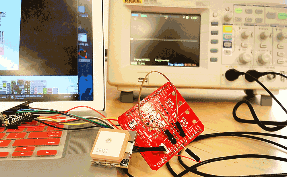
The Second Project: Monitoring Air Quality
Gather environmental data (air quality, weather) and transmit to a corresponding app.
Next Steps:
Hackathon to design sensor kits, July 14th - July 21st, 2017
Design, troubleshoot, and prototype kits. August 9th, August 12th, 2017
Strategy/brainstorming sessions for the data and design, September 24th, 2017, 10AM - 5PM
Final design/engineering session for sensors. January, 22nd, 2018, 3PM - 7PM
Data focus and sensor placement session. February 19th, 2018, 3PM - 7PM
Data analysis, visualization, and schematic documentation session. March 12th, 2018, 3PM - 7PM
Data storytelling, visualization, educations session. April 9th, 2018, 3PM - 7PM
Build sessions for the kits.
Offer workshops that prepare interested collaborators in data science and machine learning/AI; in mapping and GIS; in microcontrollers; and in creating immersive and interactive experiences including mixed reality, apps, mapping, and installations; analyze data; visualize our insights and the ecological and cultural history of this ecosystem. In the spring facilitate a week-long curriculum hackathon to design assignments, projects, and modules with middle and high school educators. Hold hackathons and design/build in the spring to complete the data analysis and visualizations/stories.
Look for the wonderful presentations, stories, and installations on Earth Day and International Migratory Bird Day 2018.
Join Us For the Project
Partners and Sponsors:
- Audubon Society of Portland
- Cornell Bioacoustics Research Lab
- Crowd Supply
- Intel
- Nordic Semiconductor
- PJRC
- Portland 3D Printing Lab
- Public Lab
- Sandy River Basin Watershed Council
- Sigma Xi Columbia-Willamette
- Vesper
Organizers
- Nandini Ranganathan
- Richard Beckwith
Art Directors
- Amy Bonin
- Daniel Verde
Participants
- Abdul Fitouri
- Alexis Fenn
- Allison Ongaro
- Amber Marsh
- Amelia Bauerly
- Andrew Ferlitsch
- Andrew Martz
- Andrew Mears
- Anselm Hook
- Arthur Smid
- Ben Purdy
- Bennett Battaile
- Bill Evans
- Bob Holmström
- Bob Sallinger
- Brad Jackson
- Camille Kyle
- Candace Hazelwood
- Carrie Carter
- Chester Ismay
- Chris Eykamp
- Chris Hansen
- Christine Kendrick
- Colin McNamee
- Craig Winslow
- Daniel Newberry
- Daniel Teibel
- Debbie Leick
- Danny Verde
- Douglas Hanes
- Dylan McNamee
- Emanuel Castro
- Giuliano Bruno
- Grady Shelton
- Gregor Yanega
- Harold Becker
- Harold Mills
- Hector Dominguez
- Holger Klinck
- Horatio Law
- Howard Silverman
- Jack Stringer
- Jaron Heard
- Jay Melican
- Jay Udelhoven
- Joe Liebezeit
- Jorge Munoz
- Jesse Jenkins
- Joseph Wells
- Joshua Lifton
- Julia Betts
- Kathy Shearin
- Katie Enzweiler
- Katie Meckes
- Katy Weil
- Kim Hack
- Lauren Goding
- Linda Mantel
- Mareika Glenn
- Marin Vesely
- Marissa Anderson
- Matthew Bowers
- Matthew Sottile
- Max Ogden
- Meenakshi Rao
- Megan McKissack
- Melissa Gregg
- Mert Kocabagli
- Mike Heavers
- Michelle Girts
- Mikai Lewis
- Misty Mesaga
- Monica McGrane
- Nanda D'Agostino
- Nandini Ranganathan
- Ophir El-Boher
- Paul Reynolds
- Paul Stoffregen
- Peter Russo
- Philip Orlando
- Randy Goossen
- Reese Bowes
- Reid Blomquist
- Richard Beckwith
- Rob Bekuhrs
- Sarah Bailey
- Scott Chamberlain
- Sean Yeager
- Shashi Jain
- Sonya Neunzert
- Stephanie Mendoza
- Steve Wise
- Steven Parton
- Sue Slagle
- Tom K
- Thomas Orlowski
- Trace Harris
- Victoria Wells
- Violet Peña
- Whitney Bailey